A mine investigation must explain more than whether a building can stand on its plot. By the end, you will be able to define the investigation boundary, match field methods and depths to each mine component, and specify the records and design assessments needed for a defensible ground model.
Key takeaways
- Map waste dumps, haul roads, stockpiles, pits and drainage—not only buildings.
- Set borehole depths, sampling intervals and groundwater observations before fieldwork.
- Compare strength, settlement, permeability and expansive-soil risks with each structure’s loads.
- Require signed logs, laboratory reports, coordinates, sections and design recommendations.
Define the Investigation Area Around Every Mine Component
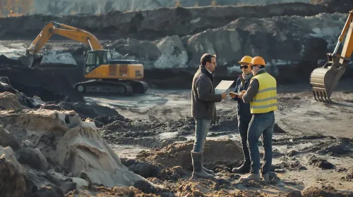
The investigation area must follow every decision that can change stability, settlement, drainage, access or production—not just the proposed building footprint. For soil investigation for mining sites near Nagpur, map the actual geological unit and groundwater regime across the mine.
A shallow borehole beneath a workshop can miss weak spoil, a shear zone beneath a bench or seepage below a dump.
| Component | Area to investigate | Decision supported |
|---|---|---|
| Open-pit mine | Pit walls, benches, ramps, haul roads, drainage channels and nearby highwalls | Slope angles, dewatering, road formation and excavation safety |
| Waste and ore storage | Overburden dumps, waste dumps, stockpiles, backfilled ground and their toes | Bearing capacity, settlement, shear stability, erosion and foundation placement |
| Processing and support | Crushers, conveyors, workshops, substations, retaining structures and worker buildings | Foundation type, differential settlement, vibration and excavation support |
| Water and underground works | Tailings embankments, slurry areas, settling ponds, portals, shafts and subsidence zones | Seepage control, embankment stability, ground movement and closure risks |
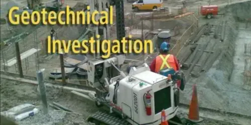
A geotechnical investigation for mines must connect each mapped area to a separate assessment:
- Soil and rock bearing capacity, total and differential settlement
- Bench, highwall, excavation and waste-dump stability
- Drainage, erosion, seepage and retaining structures
- Liquefaction where saturated, loose deposits exist
- Local soil amplification and seismic settlement; Nagpur’s Zone II label under IS 1893 does not replace a site-specific profile
Extend the boundary beyond the lease footprint where drawdown, runoff, blasting or subsidence can affect roads, ponds or neighbouring structures. Use IS 1892’s reconnaissance, exploration, sampling, groundwater observation, testing and reporting sequence for each relevant mine stage.
Build a Site Investigation Plan Before Drilling
Choose investigation points from the failure risk, not from the nearest building footprint. Plot pit limits, benches, highwalls, ramps, dumps, stockpiles, tailings embankments, ponds, roads, crushers, conveyors and every permanent foundation on one plan, then mark geological contacts, suspected shear zones, drainage paths and filled ground.
| Mine feature | Preferred investigation method | Depth and location decision |
|---|---|---|
| Pit slopes, benches and highwalls | Boreholes, oriented rock cores, scanlines and discontinuity mapping | Extend below the proposed final slope and across suspected weak layers or faults |
| Waste dumps, stockpiles and tailings | Trial pits, boreholes, in-situ density and shear-strength testing | Sample each material zone and founding stratum; investigate the full loaded footprint and toe |
| Buildings, crushers, conveyors and tanks | Boreholes with SPT, sampling and laboratory testing | Continue below the stress-influenced zone until competent bearing material or controlling weakness is established |
| Roads, drains, ponds and underground openings | Trial pits, boreholes, permeability and groundwater monitoring | Place tests along alignments, cuttings, embankments and low points; extend below excavation or embankment influence |
Use closer spacing where ground changes sharply, loads are heavy, slopes are high or consequences of failure are severe. Record the reason for every point rather than applying a uniform grid.
Follow IS 1892 as a staged process: reconnaissance, exploration, sampling, groundwater observation, laboratory testing and reporting. Install piezometers where water affects slopes, excavations or foundations; a drilling-day water level is not automatically the design level.
For mine foundation soil testing, include particle-size distribution, Atterberg limits and expansive-soil tests in black cotton soil. Treat uncontrolled spoil as unverified ground, and make a geotechnical investigation for mines produce separate assessments for settlement, stability, drainage, erosion, liquefaction and bearing capacity.
Screen Nagpur Ground Conditions and Record Field Evidence
A borehole that ends in competent basalt can conceal weak ground beside it. Good soil investigation for mining sites near Nagpur must identify the geological unit at each work area: Deccan Trap basalt, Gondwana formations near the Kamptee and Umrer coalfields, residual soil and local alluvium. Do not apply one district-wide bearing pressure.
| Ground condition | Investigation change | Field evidence to record |
|---|---|---|
| Massive, vesicular or amygdaloidal basalt | Extend coring through weathered rock and proposed founding level | Recovery, RQD, fracture frequency, weathering grade, joint spacing, infilling and condition |
| Clay-filled joints or shear zones | Add oriented structural logging, permeability checks or targeted cores | Depth, thickness, orientation, material description and water staining or seepage |
| Waste dump, spoil or backfill | Test settlement and shear behaviour; verify engineered placement before using it for foundations | Material classification, lift thickness, moisture-density results, field compaction and variability |
| Residual or alluvial soil | Sample changes in density, plasticity and saturation across the footprint | Layer boundaries, colour, consistency, recovery, sample condition and test interval |
| Seasonal or perched groundwater | Install observation points and repeat readings through representative wet and dry periods | Date, time, depth below ground level, casing details, seepage rate and water level |
Every log must carry traceable coordinates, reduced level, borehole or trial-pit number, date, drilling method, diameter, depth, sample number, recovery and refusal details. Record groundwater before and after drilling, not just the first water strike. These records support mine foundation soil testing and let reviewers distinguish rock quality from drilling performance.
Use IS 1892 for the staged reconnaissance, exploration, sampling, observation, testing and reporting trail.
Turn Test Results Into Structure-Specific Design Assessments
A mine report is useful only when test results become structure-specific design decisions. A geotechnical investigation for mines should report bearing capacity, total settlement, differential settlement, shear strength and groundwater conditions for each proposed foundation area—not one site-wide “safe bearing capacity.”
- Foundations: state allowable and ultimate soil or rock resistance, settlement estimates, founding depth, excavation condition and whether shallow, raft or deep foundations are suitable. Mine foundation soil testing must also identify heave risk in black cotton soil through particle-size distribution, Atterberg limits and, where required, swell pressure or free-swell testing under IS 2720.
- Benches and highwalls: provide rock-mass or soil shear parameters, discontinuity orientation, pore-pressure conditions, failure modes and stable bench, slope and haul-road geometries.
- Dumps and stockpiles: distinguish engineered fill from uncontrolled spoil, then assess lift thickness, compaction, spatial variability, settlement and shear strength. Do not treat waste as natural competent soil without placement evidence.
- Excavations: specify temporary and permanent slope angles, support systems, basal stability, piping risk and dewatering effects.
- Drainage: identify seepage paths, design groundwater levels, erosion-prone materials, runoff controls and drainage capacity for channels, ponds and retaining structures.
The measured drilling water level is not automatically the design level. Record drilling-fluid effects, allow boreholes to stabilise, and install piezometers where pumping or seasonal changes could alter effective stress, settlement or slope stability.
For seismic design, state the site soil or rock profile, liquefaction susceptibility in saturated loose deposits, local amplification and differential-settlement risk. Nagpur lies in Seismic Zone II under IS 1893, but the zone label does not replace site-specific seismic input.
Specify Deliverables When Selecting an Investigation Provider
Accept a report only when its conclusions are traceable to locations, samples, test methods and calculations. A soil investigation company in Nagpur should provide evidence, not just a polished PDF with borehole counts and a single allowable bearing pressure.
1. Require a location plan and coordinate register showing every borehole, trial pit and in-situ test, with eastings, northings, reduced levels, ground elevations, dates and drilled depths. Match these points to mine benches, highwalls, dumps, roads, drainage works and foundation footprints.
2. Check each field log for strata descriptions, drilling method, recovery, sample depth, sample condition, groundwater strikes and final water levels. Ask for photographs where core condition, spoil placement or joint infilling affects interpretation.
3. Match laboratory reports to unique sample IDs and chain-of-custody records. Require test standards, equipment calibration certificates, moisture-density and compaction records for engineered fill, and dedicated settlement or shear-strength results for uncontrolled spoil.
4. Demand rock logs that separate core recovery from RQD, fracture frequency, weathering grade, joint condition, infilling and water. Basalt can change from massive rock to clay-filled joints within a short distance.
5. Require signed calculations and separate assessments for bearing capacity, settlement, excavation support, highwall and dump stability, drainage, erosion and liquefaction where saturated loose deposits exist. Check that the reporting framework cites IS 1892 and explains rejected or abnormal results.
Becquerel Industries Pvt Ltd can be compared on whether its proposed scope and final records satisfy this audit trail, rather than on the number of tests listed in a quotation.
Frequently asked questions
What area should a soil investigation cover around a mine?
Cover every mine component that can change stability, settlement, drainage, access or production, including pits, waste dumps, haul roads, stockpiles, plant buildings, drainage works and foundations. Map the geological unit and groundwater regime across the mine rather than testing only a building footprint.
What should a mine site investigation plan specify before drilling?
Specify investigation locations, borehole depths, sampling intervals, in-situ tests, laboratory tests, groundwater monitoring, access requirements, survey coordinates and the decision each test will support.
Which ground conditions should be screened near Nagpur?
Record soil and rock layers, weathering, fractures, groundwater levels, drainage paths, filled ground, loose deposits, hard strata and field evidence of expansive or collapsible soil. Preserve photographs, sample descriptions, refusal depths and borehole coordinates.
How should test results be used for mine structures?
Convert results into structure-specific assessments for bearing capacity, settlement, slope stability, excavation support, seepage, pavement performance and foundation type. Use the loads, geometry, drainage conditions and construction sequence of each structure.
What deliverables should you require from a geotechnical investigation provider?
Require a signed report with a site plan, borehole logs, coordinates and elevations, sampling records, groundwater observations, laboratory certificates, test methods, interpreted parameters, geological sections, limitations and recommendations tied to each mine component.
Keywords